A circuitous route to Santiago de Compostela, Spain. Stage One beginning in Munich, Germany ending in Jerusalem - traveling through Austria, Italy, Albania, Macedonia, Greece, Turkey, Cyprus and Israel. Second stage from Vienna, through Germany, Czech Republic, Holland, Belgium, France and Spain.
Final destination - Santiago!

Post Script: The changeable situation in Jerusalem has led to a change in plans. The Rome to Jerusalem leg of this journey has been changed to the 'End to End' in the UK, after which the journey will resume as above in Vienna.

Monday 29 September 2014

Inverness, the end of the first stage.

Day 6, Dornoch to Tain, 17.15 kms.
Day 7, Tain to Rosemarkie, 34.15 kms.
Day 8,   Rosemarkie to Inverness, 29.3 kms

Day 9, 10, 11 are in Inverness - waiting for a parcel of winter gear to be delivered from home, and so the only walking has been sightseeing around Inverness.

At last I have finished with the A9!  What a relief this is.  The last couple of days into Inverness I managed to mostly avoid it.  From Tain I walked along it for a few miles before heading off and detouring down the Black Isle, only having to return to it again to cross the Kessock Bridge into Inverness.

There has been a mixture of pleasant walking, though a couple of very long days, along quiet back roads, and resting here in Inverness ready to tackle the next leg.

Travelling from Dornoch to Tain the A9 crosses the Dornoch Firth on a comparatively new bridge.  The wind was strong as it whistled up the Firth, but the views were great.
In Tain the primary school is perched on a hill overlooking the Firth.  The Firth is quite tidal and so the view would be constantly changing. I would imagine it would be quite a distraction if one's desk were near the window!
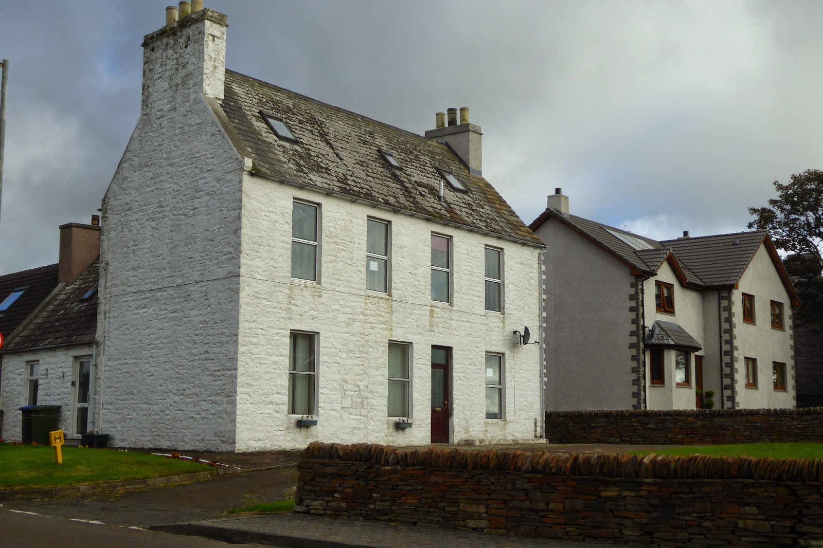
Tain had many pot plants lining the street.  This memorial is on the edge of a rose garden, designed and planted by members of the community.  I had been told that Tain was not a tourist town, but I found it rather interesting, and its residents particularly friendly.
Tain was a centre for pilgrimage back in King James day (further Duthac).  This memorial gate says "The Pilgrimage", and was funded by donations in the late 1800's in memory of William Ross, a banker in the town, "as a testimony of his personal worth and useful public life"!
The view from the B & B  in Tain towards the Dornoch Firth.

After Tain I travelled down to a place called Nigg. I didn't realise it, but there is a lot of oil industry here.  As I walked towards Nigg I could see the oil riggs in the distance looking like they were some alien space ship just landed in the field. The nearer I got the further they seemed to be, perched on their great legs out in Cromarty Firth.  I had to walk around the massive oil storage tanks and power facility before reaching the ferry, which I was very glad to see!

The wind had risen as the morning wore on, and when the ferry arrived from the other side Davey, the ferryman, checked as to whether I was only wanting a single or return ticket.  On hearing "single" he ushered me on board.  His reasoning was that with the wind rising like it was there was every chance that the ferry would shut down and had I wanted to return I wouldn't have been able! 
The beach where the ferry comes in, looking towards the headland that makes this firth a wonderful sheltered harbour.
The village of Cromarty, viewed from the ferry.
This tiny little two car ferry is one of the smallest in operation in the UK. It has a revolving circle on the deck so that cars can be turned around and thus be able to drive off, rather than having to reverse.
The oil rigs in the Cromarty Firth.
At Davey's suggestion I went to the Cromarty Museum, one of the best local museums I have seen, and free.  This building used to be the court house many years ago and in the court room there are a number of mannequins, very realistically made up, and a sound a light show depicting an actual trial - a drunk and disorderly!
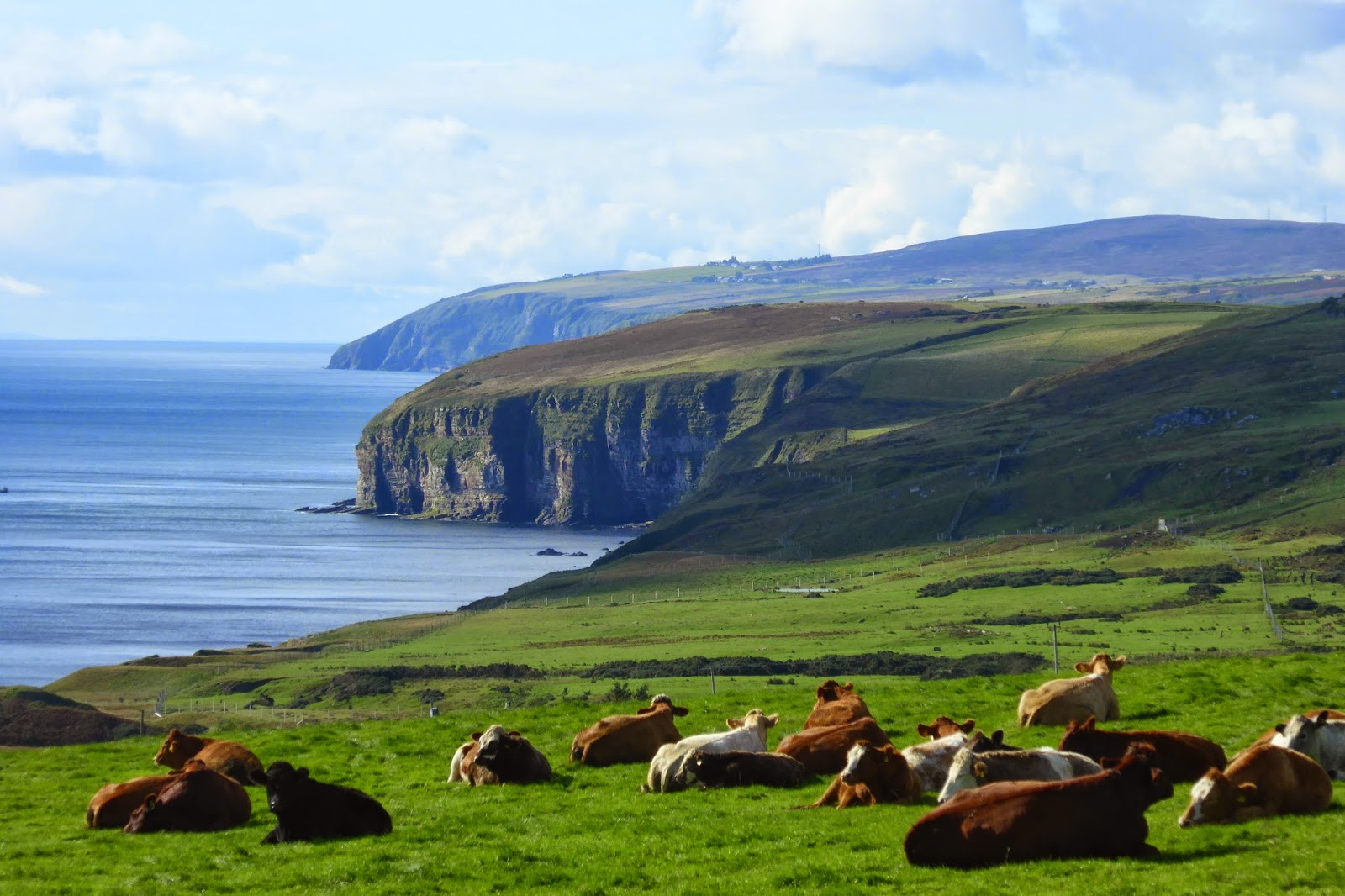
Cromarty is tucked in out of site below the trees, and Nigg is on the other side of the Firth.  This is known as the Black Isle for a couple of reasons - because of the very black soil, and possibly because in winter the hills on all sides across the firths are covered with snow and this small peninsula is not - hence black (no snow) and white (with snow)
Travelling down the Black Isle, looking towards Cromarty Firth on my right .........
......... and Moray Firth on my left,
..... and after a VERY long 34 km day, walking into the village of Rosemarkie.
There are dolphins that play here at Rosemarkie, but I was too tired night I arrived to look for them, and the wind sprang up overnight and because they aren't fond of choppy water I didn't see them the next day.
I had dinner in this restaurant.  It is owned by Penelope Keith, but she didn't pop out to serve me!
I had been given directions for a variety of different paths to get to Inverness, primarily quiet single lane roads, but also an old train track, now a walking track.  The day, though long should have been quite easy, but I found myself having to go from one WiFi point to the next while I tried to sort out why my parcel had not yet arrived in Inverness.  One of the reasons was that they were trying to give me someone else's parcel, and when I checked the weight of it (17kgs) I then  realised we weren't on the same page.  Eventually got my three kgs of second hand winter clothes cleared through customs without having to pay VAT!  I am still waiting for it to be delivered however!
 The path, an old rail track, between Fortrose and Avoch (pronounced Ork)
 Munlochy Bay, not far from Inverness.
 This pub at Munlochy was one of my WiFi stops on the way to Inverness.
The Kessoch Bridge, leading into Inverness.

Inverness is a lovely city.  It has an annual rainfall of 25 inches per year.  I am headed to Fort William which has a average annual rainfall of 80 inches which at a rough guess means I'm headed for rain!
 Inverness has a castle, though it is not open to the tourist public - its a magistrates court
 On the way through the city on Saturday I dodged a "Yes" rally.  The referendum has finished but it appears the battle continues.
This clock tower is very near a castle built by Cromwell, which was promptly demolished after Cromwell's demise.
Flora MacDonald shields her eyes as she looks out to where Culloden is.  It is said that she rescued Bonnie Prince Charlie from the battlefield and helped him to safety.

Tuesday 23 September 2014

Getting close to Inverness

Day 3, Lybster to Dunbeath, 13 kms
Day 4, Dunbeath to Helmsdale, 25.4 kms
Day 5, Helmsdale to Brora, 19.5 kms
Day 6, Brora to Dornoch, 24.8 kms

I know the A9 highway very well.  Until today I have trudged along it every day.  It has got progressively busier the further south I have come.  The villages have been lovely, just getting to them has been a bit tricky at times.

Leaving Brora today I walked along the beach for about five miles, before having to get back on the A9 again so I could get around a Loch.  Once around the loch though I was able to get on a quiet back road again.

I am hopeful of being able to avoid the A9 for most of the way left to get to Inverness is short, so will let my photos tell the tale.
 Leaving Lybster.
 Just a bit further along.
It was so good to have a clear day and be able to see the views ahead and behind.  The segment along the coast on the way to Dunbeath was stunning.

 Heading to Dunbeath, though the day started sunny and clear, it finished quite hazy (below)
Dunbeath Harbour with the castle on the hillside. 
 I had so many warnings about the Berriedale Braes, they were steep, no verge and very dangerous.  A man had been killed on referendum day when his truck had jackknifed.  It turned out to be no-where as bad as I had been led to believe, and certainly no-where near as steep as the hills in Italy.  Quite a relief.
 Berriedale, and the "strath" (creek), which cut the Brae through the landscape.
 This statue was on a hill outside Helmsdale.  It is called "The Emigrants" I think it is particularly poignant.
The  inscription on the statue fits perfectly with the look on this woman's face.
"Commemorates the people of the Highlands and Islands of Scotland who, in the face of great adversity, sought freedom, hope and justice beyond these shores.  They and their descendants went forth and explored continents, built great countries and cities and gave their enterprise and culture to the world.
This is their legacy.
Their voices will echo forever through the empty straths and glens of their homeland.

Clynelish Farm, the B&B I stayed in at Brora.
Helmsdale is a salmon river.  The beehive like building at the bottom left is the ice house where they stored ice from the frozen loch so they could, in turn, store the salmon.
Both Brora and Helmsdale had similar unusual war memorials - a clock tower.  This is the first time I have seen this.  Helmsdale's (in the photo with the ice house) struck the hour, but Brora's chimed the quarter hour as well as striking.
It was lovely walking along the beach between Brora and Golspie, though hard work at times, especially on the rocks, and on the soft seaweed.
Imagine my surprise when I came around a bay, and was greeted by this sight.

This little fellow seems to be saying "do I really have to move, or can I just stay here".  Some of his rellies did go for a swim!.
Further along the beach Dunrobin Castle came into view, and I walked through the grounds (below) as I got closer.


This side is where I am going, the other is where I have come from!

Friday 19 September 2014

The End to End has begun

Day 1, John o'Groats to Wick - 28 kms
Day 2, Wick to Lybster - 22.25 kms

Well folks I have begun what promises to be an interesting, exciting, and challenging adventure.  Each post I will try and remember to put down the mileage, as I know some of you are interested in such details.  I have actually figured out how to turn the GPS on on the tablet!

Now, how have these 2 days gone you ask?  I have achieved what I wanted in terms of distance, but the going has sometimes been tough and slow.  Tough because it has been along a road, which has been quite busy at times, and the asphalt walking is tiring on the feet.  Slow, because when cars come towards me I have to leap off and get as far off the road as I can and then stop so that I know they can see me - especially the trucks!

At one point the mist was so thick vision was only about 150metres.
When I came down the stairs at the hotel a guest said to me "off for a good walk then"?  When I asked him if I looked safe he confirmed I did!

Today was better because there was only haze, not mist, and I could see cars coming.  Because the road has been reasonably flat I could actually see vehicles a long way away, which means I could also work out where the road was going.  Yesterday the mist was so thick that at times the only sense I could use was hearing.  I spent a lot of time with my head on the side, the easier to hear with.  I was actually walking next to some pretty stunning country, moorlands on my right and sea scapes on the left, but I couldn't see either, which was quite disappointing.
 The mist cleared enough at one point for me to see some of the scenes I had been missing along the coast.
 I could even make out old buildings on the shoreline.
The spiders webs made a picture as they collected moisture from the mist.
 A disused bridge on the way to Wick
A floral clock in Wick.
 On the way to Lybster I passed this cemetery, out in the fields, with a magnificent view.
This stone is called the Lybster stone and is thought to be about 1,500 years old.  It is thought to be associated with the celts - the Picts, one of the Celtic groups.  Note the "Celtic" cross in the back left corner.
My arrival in John o' Groats, as I mentioned in the last post, was also in the mist.  Over lunch I met Danny and Michelle and together we walked to the harbour and they took my photo at "the sign".  There is an official photographer who will take your photo with the date on the sign, for a fee, but Danny did just as good a job at the other sign, for free!  I did go back later and a couple of girls from London took another photo with the date switch on the camera, and I in turn took theirs.
The signpost at John o' Groats.

Also had a photo shoot at the " start / finish" line.  This has been moved and re-done since the realigning of the A9 road and in my opinion much better.  You can see for yourself in the photos below.
The start / finish "line".  NZ family - take note of where direct south is - Bluff, 12,875 miles!  Note that the date is stamped on this photo.