A circuitous route to Santiago de Compostela, Spain. Stage One beginning in Munich, Germany ending in Jerusalem - traveling through Austria, Italy, Albania, Macedonia, Greece, Turkey, Cyprus and Israel. Second stage from Vienna, through Germany, Czech Republic, Holland, Belgium, France and Spain.
Final destination - Santiago!

Post Script: The changeable situation in Jerusalem has led to a change in plans. The Rome to Jerusalem leg of this journey has been changed to the 'End to End' in the UK, after which the journey will resume as above in Vienna.

Thursday, 14 August 2014

and even tougher days!

Yes, the Cammino di Assisi is tougher than anything I have done, and poor Julie has been thrown well and truly into the deep end, and doing a sterling job at that!We have taken a break and caught the bus to the next stage.  This gives us not only a rest from carrying our packs, but also means we get two nights of luxury accommodation in a hotel, and a day to sleep in!

You have heard nothing from me since leaving Dovadola because there has been little access to WiFi.  Due to time constraints this post is going to have the photos tell the story!
Julie on day 1 heading back to collect our packs after having breakfast.

We are about to depart, already feeling the heat!
Even on this first day there were magnificent views, but there were even more magnificent views to come in the days ahead.
The path on that first day set the scene for the days ahead, through forest, sometimes a single track, sometimes a wide cart track.
.... and more views.
Here the path widens, and despite some hesitation as to which way we should go an hour or so previously, the signs here show we are not far from our destination. The red, green and white arrow is what we follow.
Sylvia, our kind and generous hostess at Rifugio Campannina waved us off when we left on our second day.
The first part of the day followed a quiet back road along the ridge, again with great views.

We arrived at the medieval village of Portico and decided to stop at the old convent, now a hotel, to have a second breakfast.  This turned into a mist wonderful early lunch.
Leaving Portico we crossed this mediaeval humpback bridge.........
............. then headed up and up this paved mule tracktrack,
......... and through the forest.
We spent the night in the village of  Premilcuore.  That night we had dinner in a square around the corner from here.  It was in a community piazza and was part of a fiesta for St Lawrence, with a concert to follow.  There were about 50 minutes of thank yous and pats on the back before the entertainment began and so we only saw a bit of the concert, though we heard it for quite a while as we walked back to the refugio.
Leaving the next morning we went through this gate and followed the path along the river, steadily climbing.
We passed another humpback bridge......
The stream we walked beside before tackling the steep part of the path.
..... before climbing up steeply to this ruin.

 This day we climbed from 500 metres up to a height of 1,100 metres.  The first six were quite comfortable, but then it was STEEP!
I am staggered at ho wild the country is that we are walking through.  Steep ravines on either side, and from this point the ridge we are walking on is only about 10 metres wide.  The forest, birch, beech, ash, oak, cedar, just seems to go on for miles and is unbelievably dense in a lot of places, opening out going through the pines. It is hundreds of years old.
 We skirted around this lovely field before a VERY steep descent into Corniolo
This refugio in Corniolo was a converted mule stable.  Kitchen annnd bathroom downstairs and 5 bunks upstairs.  Even "a clothesline out the back" as the song says!
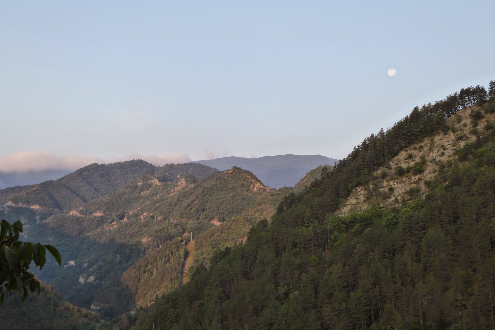
The view about 50 metres from the refugio.  The blue hill in the distance is the 1400 m one we are headed to!
Nearly to the top........
 ...... and just some of the paths we were walking on.


The refugio (where the clothes airer is) at Camaldoli. 
The view from the ridge.  This was a HARD SLOG up to 1,520 metres from about 600 metres!  We then descended to the refugio (previous  picture) at Camaldoli at around 800 metres.  This day was so exhausting we decided it was time to catch a bus.
A chestnut tree in the forest behind the refugio in Camaldoli.  For South Aussies reading this - it reminds me of the Herbig tree.
A Romanesque church in Badia Pratella.  We got a lift to here by a doctor from Rome, who was "old" so he says.  We tip he was our age, but didn't divulge that to him.  We offered to buy him a coffee but he didn't accept, pointing to his pulse and saying he had "pressure"!
The exterior of the church, and the village behind.  Note the footprint of the chestnut tree log.


Friday, 8 August 2014

........and more tough days!

Another three tough walking days, up hill and down dale.  Added to that I have had some fierce weather, very hot, with very high humidity.  When I was leaving Rifugio ca 'carne I could see rain in the distance coming my way.  Although there was thunder and lighting, in this instance I wasn't concerned as I was descending and not exposed.  The rain, when it came, was torrential and within about 10 mins I was soaked through.  Water was gushing everywhere, and I had to be extremely careful not to slip in the water and on the clay soil, just inching my way down the hill.  I continued to drip my way through the next village and up the next hill, and though the dripping eventually stopped the humidity was so high that I didn't dry out that day at all.
The rain is coming!

This delightful beast, part wolf, was part at home at Rifugio ca 'Carne.

Because I was dripping so much I lost enthusiasm to explore, but this is an old church on the outskirts of Brisigella.

This is the hill that I accidentally descended, and then of course had to ascend!  I went around the corner past the house in the distance, and down a very steep incline.  Pity I didn't decide earlier that it was the wrong way!

Modigliana
The path went through streets like this in Modigliani....

......... and went past what is left of this castle, Rocca del Continue Guidance, known as Roccaccia.

If you look carefully at the left bank you can see the flattened grass from the torrent that must have come down after the downpour earlier in the day.  This mediaeval humpback bridge, Ponte S. Donato, or "della Signora", in Modigliana was just around the corner from where I stayed.


I have started thinking of the day ahead by the number of hills I have to climb.  The easy days tend to be the one hill days, as it is usually a steady uphill plod and then down again, with a few severe steep bits thrown in for good measure.
Leaving Modigliani.

The three hill day was harrowing.  My accommodation was some distance from the village and my hosts gave me a lift in their camper van to the path, several kilometres away.  Soon after though there was a discrepancy in my notes and the signs and three times on the advice of people passing I went the wrong way, wasting precious early morning coolness, and energy!  Eventually I got it sorted and paused part way up the hill to check I was right - I was still heading to the "start" of the morning - when a man in a camper van stopped and assured me I was heading the right way.  "Nothing ventured nothing win" so I asked him if he could give me a lift to the top of the hill.  I hate hills!  He opened the back of the van and I perched on the bench at the kitchen table for about 600 metres.  We passed the sign where he told me I had to go, and continued on to his house.  He took me round the back of his house and pointed out where the path went over the first hill. Was I glad of that information later, as I pushed onwards, sometimes filled with doubt as to where I was, it meant I could call up that mental picture and reassure myself I was headed the right way.
This is one of the rocky bits on the three hill day!
and more paths.


What a way it turned out to be.  Steep narrow paths, one descent so steep I crawled down the slippery clay, making progress in 6 inch increments!  I had to clamber over gypsum outcrops, looking as if the path had been laid with glass mosaics, push the wet undergrowth aside as it dripped all over me, and at one point leapt out of my skin when a couple of feet in front of me a snake (probably a viper I'm told) wriggled into the undergrowth.

I was reassured seeing a set of footprints in the wet soil, telling me someone had passed by since the last rain twelve hours earlier, but it didn't look as if there was a lot of traffic on the path at all.  With this in mind, on seeing a car with three men in it, part way down the second hill I decided it was time to hitch a ride!

I love the men I'm meeting on this way!  Very chivalrous, kind, and generous.  These three men not only said yes to taking me to the bottom of the hill, but when I told them where I was headed they took me nearly there,  not the whole way because the road stopped.  They didn't leave me there, getting out and escorting me to the door.  I bought three beers that day - one for each of them as a thank you!  I was particularly relieved not to have to walk up that third hill, as, apart from it being stinking hot by then, I was staring to get a bit nervous about the terrain I had been walking in and I had been warned about watching for the signs because the grass was very long.  Prudence prevailed, and those three grubby men will never really know how grateful I was for their willingness to go out of their way and help me!  By the way, they were grubby because they had spent the day working on a new path - the crystal path - linking caves that the Romans used for gypsum.  They were speleologists. I might add my stay at Rifugio was a delight, capped off by a wonderful meal, again in the company of two charming Italian men, who for my benefit spoke English the whole evening.
It wasn't until the second last day of the Camino Sant' Antonio that I met other pilgrims, so this is a rare sight!  These three met me as I was ascending the two kilometres I had gone down, until I decided I was wrong and went back up again!  Not sure what they did because they didn't speak English, but I went back out to the road and went down there instead, having added another 7 kilometres to my 20 kilometre, 2 hill day!  Note the snow plough sign.

A memorial to cyclists. 
On the way into Dovadola the path goes past this church, an important site in re!ation to Saint Antonio.  I went in and was having a quiet sing when the three Italian pelegrini came in to have a listen.  They were surprised, and appreciative which was nice.  The first stage of the Camino di Assisi goes back up the hill to this site, but I don't do hills twice by choice so we will take a short cut!

The path into Dovadola goes down past the farm in the distance, and of course, just to finish the day off in style, there is a very steep narrow path to come!

I am now in Dovadola and Julie has arrived.  With our registration for the Camino di Assisi we have been given little maps and directions in English.  I have yet to point out to Julie the way I measure a day, but let me say there are quite a number of two and three hill days!  But more of that as we cover the distance.

Sunday, 3 August 2014

Tough Days

The last three days have been very tough hiking.  I would rate them just about as tough as any bushwalk I have done, with the exception that there has been at least one cafe per day to get refreshments, a shower and a comfy bed each night, and clean clothes at the start of each day.
Even leaving Bologna had its difficulties, with time being wasted walking in circles at one point until I found this - the first sign.  All up hill from here!

The other thing that is different is that there have been kind, and generous, people to help me along the way.  People like Claudia and her husband Sylvano.  They gave me a delicious dinner the night I arrived at their place (below), and then the next day Claudia loaded me up with food to eat on the way and Sylvano took me to the start of the path, shaving some distance but more importantly making sure I didn't get lost right at the beginning of the day.
Casa Claudia.  We had dinner sitting outside in the soft warmth of evening.
Sylvano dropped me at the start of the Flaminia Minor, an old Roman road, which naturally goes straight up!  Near the top of the first hill this rock was a perfect place to catch my breath.
This was the view I had as I left Sylvanos car - the path, first descending, and then snaking its way uphill along the ridge top.
On my first day away from the city, I must admit there were a couple of times where I wondered if I was on the right path!
especially on this stretch!  Where is it!!!
Sometimes there were special little rest stops though, making for a pleasant interlude.

The trail is generally well marked, but every so often there is a marker missing, which happened yesterday when I found myself about 2 kms downhill, past where I should have turned off.  It was hot (very), and the prospect of climbing back up did not appeal and so I flagged down a car and asked them to take me back to where I had missed the path.  I found myself in a car with three noisy people arguing about where I should be!  To curb their debate I got out the Italian version of my notes and passed it to them, and, once we were there they got out of the car, re-read the notes confirming that the unmarked dirt track WAS the right one and sent me on my way.
It was at the church tower that I missed the turn,
and this is the steep path I took (looking back up the hill) - the tower is in the distance.
Looking across at the house where I should have been in the distance.  This gives you an idea of the sort of management issues to be dealt with in terms of road works.

At the end of this day I was headed for this village, San Martino in Pedriolo.  I stayed at a refuge next to the church, the red building in the distance.
The accommodation was basically half of the first floor of the building next to the church.  It had a lounge room, kitchen, two bedrooms sleeping about 6 - 8 in each and a roomy bathroom and laundry.  I had the place to myself.

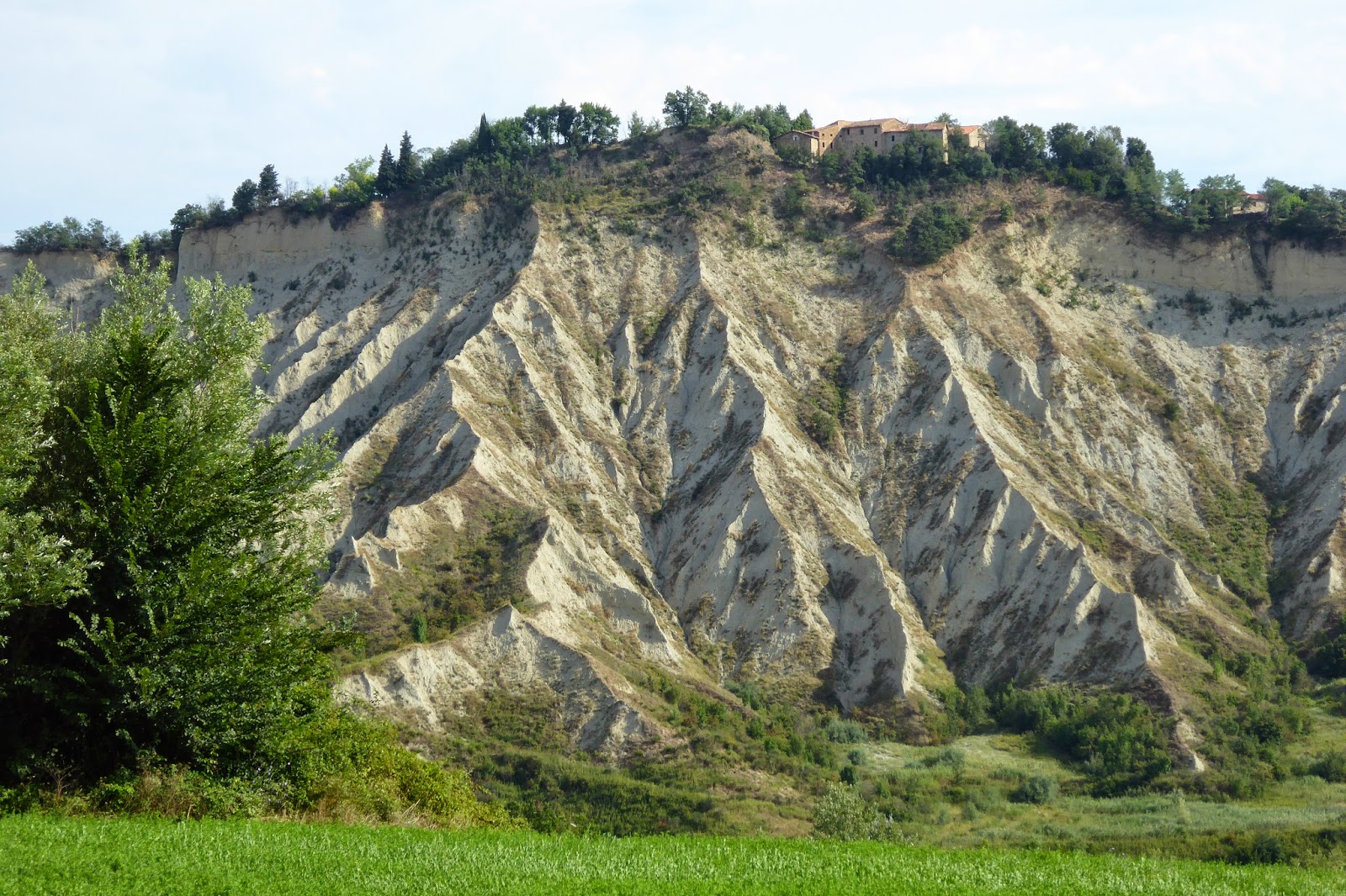
This is an ancient land I am passing over, but very unstable.  There is no rock in the soil, it being a chalky, clay based consistency.   I am walking on fragile ridge tops where, today, there were parts of the road that had sunk as the land subsided.  Indeed several guard rails I passed wouldn't have stopped a thing - they were hanging in mid air!  All that remained of a church on the hilltop was it's tower - the rest of the building had collapsed.  Apparently these land formations are always on the south side of the slopes, where it is coldest in the winter and the northern slopes are flourishing with crops, vineyards and fruit trees.  It must be unbelievably difficult for the authorities to manage the infrastructure such as roads, but also for the farmers whose land is slowly being eroded away.
The building might be falling down, but the vegetable garden is well tended.
I quite often use guard rails to have a seat and a short rest, but not this one.  That middle post is not attached to anything, and the ones out of sight have a distinct lean.
These land formations are fascinating.  I have to school myself to restrict the photos passing them!
I thought the first formations were fascinating until I went around the corner and down the hill and saw the size of them, and this is only a part of it!  On the top of the hill you can see the church tower which remains standing, though the rest of the building collapsed.  This kind of country makes for long distances walking too.  I actually walked past the tower, then the path came around to the left of the picture along the ridge, at times no more than a large car width wide, and then swung around the base of these "hills".
One has to wonder how long before that house will remain there.

Again I think of the song "the wise man built his house upon the rock".  The trouble is there is no rock here to build upon!