A circuitous route to Santiago de Compostela, Spain. Stage One beginning in Munich, Germany ending in Jerusalem - traveling through Austria, Italy, Albania, Macedonia, Greece, Turkey, Cyprus and Israel. Second stage from Vienna, through Germany, Czech Republic, Holland, Belgium, France and Spain.
Final destination - Santiago!

Post Script: The changeable situation in Jerusalem has led to a change in plans. The Rome to Jerusalem leg of this journey has been changed to the 'End to End' in the UK, after which the journey will resume as above in Vienna.

Sunday, 3 August 2014

Tough Days

The last three days have been very tough hiking.  I would rate them just about as tough as any bushwalk I have done, with the exception that there has been at least one cafe per day to get refreshments, a shower and a comfy bed each night, and clean clothes at the start of each day.
Even leaving Bologna had its difficulties, with time being wasted walking in circles at one point until I found this - the first sign.  All up hill from here!

The other thing that is different is that there have been kind, and generous, people to help me along the way.  People like Claudia and her husband Sylvano.  They gave me a delicious dinner the night I arrived at their place (below), and then the next day Claudia loaded me up with food to eat on the way and Sylvano took me to the start of the path, shaving some distance but more importantly making sure I didn't get lost right at the beginning of the day.
Casa Claudia.  We had dinner sitting outside in the soft warmth of evening.
Sylvano dropped me at the start of the Flaminia Minor, an old Roman road, which naturally goes straight up!  Near the top of the first hill this rock was a perfect place to catch my breath.
This was the view I had as I left Sylvanos car - the path, first descending, and then snaking its way uphill along the ridge top.
On my first day away from the city, I must admit there were a couple of times where I wondered if I was on the right path!
especially on this stretch!  Where is it!!!
Sometimes there were special little rest stops though, making for a pleasant interlude.

The trail is generally well marked, but every so often there is a marker missing, which happened yesterday when I found myself about 2 kms downhill, past where I should have turned off.  It was hot (very), and the prospect of climbing back up did not appeal and so I flagged down a car and asked them to take me back to where I had missed the path.  I found myself in a car with three noisy people arguing about where I should be!  To curb their debate I got out the Italian version of my notes and passed it to them, and, once we were there they got out of the car, re-read the notes confirming that the unmarked dirt track WAS the right one and sent me on my way.
It was at the church tower that I missed the turn,
and this is the steep path I took (looking back up the hill) - the tower is in the distance.
Looking across at the house where I should have been in the distance.  This gives you an idea of the sort of management issues to be dealt with in terms of road works.

At the end of this day I was headed for this village, San Martino in Pedriolo.  I stayed at a refuge next to the church, the red building in the distance.
The accommodation was basically half of the first floor of the building next to the church.  It had a lounge room, kitchen, two bedrooms sleeping about 6 - 8 in each and a roomy bathroom and laundry.  I had the place to myself.

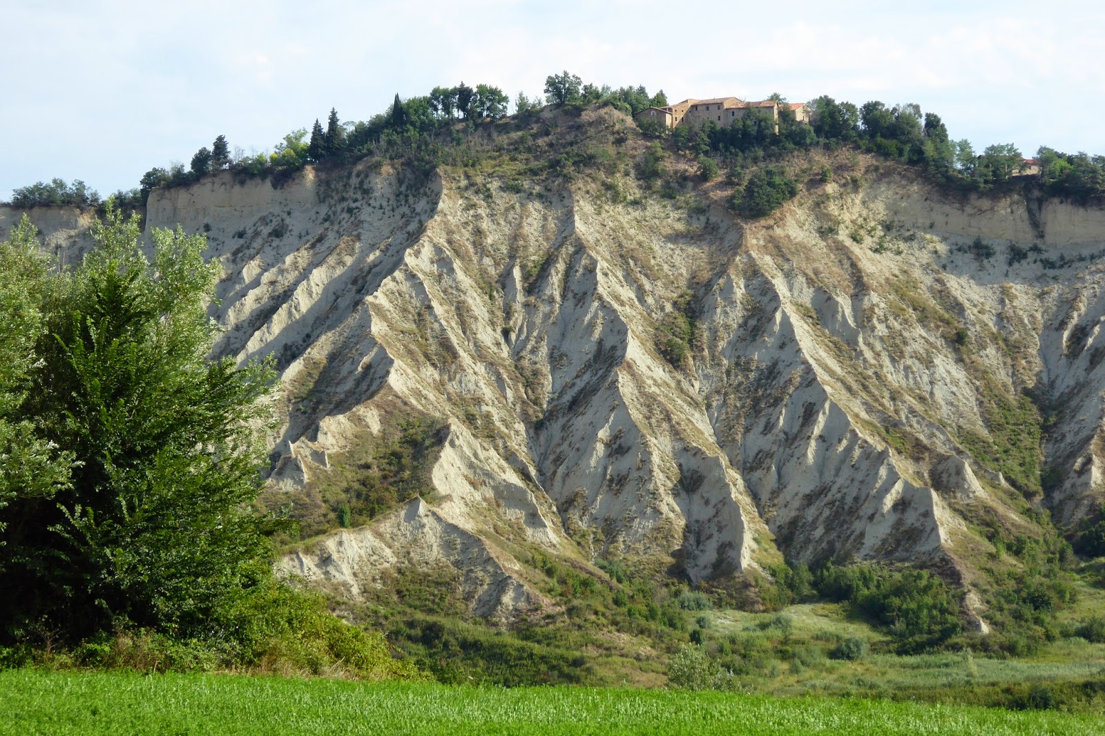
This is an ancient land I am passing over, but very unstable.  There is no rock in the soil, it being a chalky, clay based consistency.   I am walking on fragile ridge tops where, today, there were parts of the road that had sunk as the land subsided.  Indeed several guard rails I passed wouldn't have stopped a thing - they were hanging in mid air!  All that remained of a church on the hilltop was it's tower - the rest of the building had collapsed.  Apparently these land formations are always on the south side of the slopes, where it is coldest in the winter and the northern slopes are flourishing with crops, vineyards and fruit trees.  It must be unbelievably difficult for the authorities to manage the infrastructure such as roads, but also for the farmers whose land is slowly being eroded away.
The building might be falling down, but the vegetable garden is well tended.
I quite often use guard rails to have a seat and a short rest, but not this one.  That middle post is not attached to anything, and the ones out of sight have a distinct lean.
These land formations are fascinating.  I have to school myself to restrict the photos passing them!
I thought the first formations were fascinating until I went around the corner and down the hill and saw the size of them, and this is only a part of it!  On the top of the hill you can see the church tower which remains standing, though the rest of the building collapsed.  This kind of country makes for long distances walking too.  I actually walked past the tower, then the path came around to the left of the picture along the ridge, at times no more than a large car width wide, and then swung around the base of these "hills".
One has to wonder how long before that house will remain there.

Again I think of the song "the wise man built his house upon the rock".  The trouble is there is no rock here to build upon!

2 comments:

  1. THose land formations look similar to the 'badlands' behind Anzac Cove at Gallipoli- no wonder our troops struggled to climb them.

    ReplyDelete
    Replies
    1. And I must admit, this post fills me with some trepidation and thoughts of starting hill training 'quite soon' for my Easter walk in Umbria around and about a few hill towns!

      Delete